
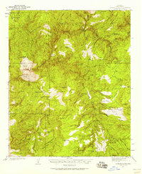
1937 Map of Diamond Butte
USGS Topo · Published 1937About this map
Tonto Creek carves a deep path through this portion of the Tonto National Forest in the mid-1930s, defining a landscape of isolated ranching and mining attempts. The presence of the Spring Creek Mine (Not Producing) suggests the ebb and flow of mineral prospecting in the canyons east of Gisela Mtn. Scattered holdings such as Vaughn Ranch, Wilbanks Ranch, and the Fred Pranty Cabin illustrate the era's reliance on high-country grazing and remote water sources like Cane Springs. Significant landmarks such as Diamond Butte and the evocative Robbers Roost Mtn tower over the network of deep drainages including Gun Creek Canyon and Hells Gate. This unedited advance sheet, surveyed by W. R. Chenoweth and others, preserves the precise locations of family-named ranch sites and seasonal cabins before many were absorbed by larger outfits or reclaimed by the forest.
Find a feature on this map
68 named features on this map. Tap any name to fly to it.
Don’t see what you’re looking for? This feature index may not catch every label — zoom into the map to look around manually.
Map Details
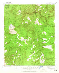
Editions of this 1937 Diamond Butte Map
3 editions found
Other maps of this area

1886 · Holbrook
USGS Topo · 1:250,000

1887 · Verde
USGS Topo · 1:250,000

1892 · Verde
USGS Topo · 1:250,000

1893 · Holbrook
USGS Topo · 1:250,000

1907 · Roosevelt
USGS Topo · 1:125,000

1909 · Four Peaks
USGS Topo · 1:125,000

1912 · Roosevelt
USGS Topo · 1:125,000

1922 · Chrysotile
USGS Topo · 1:125,000

1934 · Pine
USGS Topo · 1:62,500

1934 · Promontory Butte
USGS Topo · 1:62,500