
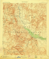
1909 Map of Four Peaks
USGS Topo · Published 1909About this map
Tonto and the surrounding ranching frontier are documented here in detail during the earliest years of the Tonto National Forest. The landscape is dominated by the massive Four Peaks and the Sierra Ancha range, with the Salt River cutting through the southern portion of the sheet. Before the major dam projects transformed the river valley, this survey shows the original topography of Mormon Flats, Tortilla Flats, and Mesquite Flats.
Find a feature on this map
78 named features on this map. Tap any name to fly to it.
Don’t see what you’re looking for? This feature index may not catch every label — zoom into the map to look around manually.
Map Details
Editions of this 1909 Four Peaks Map
2 editions found
Other maps of this area

1886 · Holbrook
USGS Topo · 1:250,000

1887 · Verde
USGS Topo · 1:250,000

1892 · Verde
USGS Topo · 1:250,000

1893 · Holbrook
USGS Topo · 1:250,000

1900 · Florence
USGS Topo · 1:125,000

1901 · Globe
USGS Topo · 1:62,500

1902 · Globe
USGS Topo · 1:62,500

1902 · Florence
USGS Topo · 1:125,000

1904 · Desert Well
USGS Topo · 1:62,500

1904 · Ft. McDowell
USGS Topo · 1:62,500