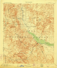
1909 Map of Roosevelt
USGS Topo · Published 1909About this map
Roosevelt Dam and the emerging Roosevelt Reservoir dominate this central Arizona landscape during the first decade of the twentieth century. The map documents a pivotal moment in the region's development, showing the Electric Power Line following the Salt River as infrastructure began to transform the Salt River Valley. Beyond the engineering of the dam, the terrain is dotted with early pioneer outposts and supply points like Schell's Station, Cline, and Sunflower Ranch.
Find a feature on this map
82 named features on this map. Tap any name to fly to it.
Don’t see what you’re looking for? This feature index may not catch every label — zoom into the map to look around manually.
Map Details
Editions of this 1909 Roosevelt Map
2 editions found

Other maps of this area

1886 · Holbrook
USGS Topo · 1:250,000

1887 · Verde
USGS Topo · 1:250,000

1892 · Verde
USGS Topo · 1:250,000

1893 · Holbrook
USGS Topo · 1:250,000

1900 · Florence
USGS Topo · 1:125,000

1901 · Globe
USGS Topo · 1:62,500

1902 · Globe
USGS Topo · 1:62,500

1902 · Florence
USGS Topo · 1:125,000

1904 · Desert Well
USGS Topo · 1:62,500

1904 · Ft. McDowell
USGS Topo · 1:62,500