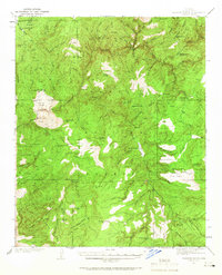
1937 Map of Diamond Butte
USGS Topo · Published 1966About this map
Tonto National Forest lands within Gila County are defined by a complex network of canyons and high mesas surveyed in the late 1930s. The landscape is characterized by isolated dwellings and cattle infrastructure, including the Old Ellinwood Ranch and Vaughn Ranch, alongside several scattered cabins such as the Hells Gate Cabin and Fred Pranty Cabin. These small outposts represent the seasonal ranching and hunting patterns of the era. Significant topographic features like Diamond Butte, Mailbox Mesa, and Robbers Roost Mtn dominate the horizon, while Tonto Creek and its many tributaries, including Houston Creek and Gordon Creek, provide the primary drainage. Local names such as Old Rock House and Buzzard Roost Camp suggest a rugged history of settlement in this part of the Sierra Ancha range.
Find a feature on this map
88 named features on this map. Tap any name to fly to it.
Don’t see what you’re looking for? This feature index may not catch every label — zoom into the map to look around manually.
Map Details
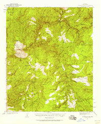
Editions of this 1937 Diamond Butte Map
3 editions found

Other maps of this area

1886 · Holbrook
USGS Topo · 1:250,000

1887 · Verde
USGS Topo · 1:250,000

1892 · Verde
USGS Topo · 1:250,000

1893 · Holbrook
USGS Topo · 1:250,000

1907 · Roosevelt
USGS Topo · 1:125,000

1909 · Four Peaks
USGS Topo · 1:125,000

1912 · Roosevelt
USGS Topo · 1:125,000

1922 · Chrysotile
USGS Topo · 1:125,000

1934 · Pine
USGS Topo · 1:62,500

1934 · Promontory Butte
USGS Topo · 1:62,500