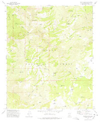
1973 Map of Diamond Butte
USGS Topo · Published 1975About this map
Ellison Mine and the Spurlock (Site) sit among the complex network of canyons and mesas within the Tonto National Forest in this mid-1970s topographical record. The landscape is defined by the deep incisions of Haigler Creek and Salt Creek, which create a difficult terrain of ridges and draws like Apache Ridge and Cabin Draw. Human activity in this Gila County area is largely tied to ranching and resource extraction, evidenced by Ellinwood Ranch and numerous water tanks scattered across high points like Fuller Mesa.
Find a feature on this map
74 named features on this map. Tap any name to fly to it.
Don’t see what you’re looking for? This feature index may not catch every label — zoom into the map to look around manually.
Map Details
Editions of this 1973 Diamond Butte Map
This is the sole edition of this map. No revisions or reprints were ever made.
Other maps of this area

1886 · Holbrook
USGS Topo · 1:250,000

1887 · Verde
USGS Topo · 1:250,000

1892 · Verde
USGS Topo · 1:250,000

1893 · Holbrook
USGS Topo · 1:250,000

1934 · Promontory Butte
USGS Topo · 1:62,500

1937 · Diamond Butte
USGS Topo · 1:48,000

1939 · Promontory Butte
USGS Topo · 1:62,500

1943 · Diamond Butte
USGS Topo · 1:62,500

1952 · Promontory Butte
USGS Topo · 1:62,500

1954 · Holbrook
USGS Topo · 1:250,000