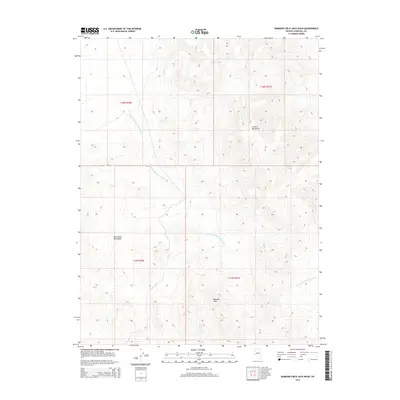
2014 Map of Diamond Field Jack Wash
USGS Topo · Published 2014About this map
Diamond Field Jack Wash cuts through this high-desert region of Churchill County, defining the drainage patterns between several prominent landforms. The landscape is shaped by the Cocoon Mountains to the northeast and the Blow Sand Mountains to the west, with the Barnett Hills rising in the south-central portion of the quadrangle. These features characterize the arid, high-elevation terrain typical of Nevada's Basin and Range province.
Find a feature on this map
8 named features on this map. Tap any name to fly to it.
Don’t see what you’re looking for? This feature index may not catch every label — zoom into the map to look around manually.
Map Details
Editions of this 2014 Diamond Field Jack Wash Map
This is the sole edition of this map. No revisions or reprints were ever made.
Other maps of this area

1908 · Carson Sink
USGS Topo · 1:250,000

1910 · Carson Sink
USGS Topo · 1:250,000

1951 · Carson Lake
USGS Topo · 1:62,500

1951 · Allen Springs
USGS Topo · 1:62,500

1957 · Reno
USGS Topo · 1:250,000

1959 · Reno
USGS Topo · 1:250,000

1960 · Reno
USGS Topo · 1:250,000

1972 · Fourmile Flat
USGS Topo · 1:24,000

1979 · Fallon
USGS Topo · 1:100,000
1979 · Fourmile Canyon
USGS Topo · 1:24,000