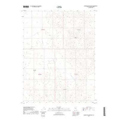
2018 Map of Diamond Field Jack Wash
USGS Topo · Published 2018About this map
Diamond Field Jack Wash carves through this arid Churchill County landscape, acting as a central drainage feature for the surrounding high ground. The terrain is defined by the elevation of the Cocoon Mountains in the northeast and the Blow Sand Mountains to the west, separated by expansive desert basins. These landforms, along with the Barnett Hills in the south, illustrate the classic basin-and-range topography found throughout Nevada. This 2018 survey detail provides precise data on the natural hydrology and elevation changes across several township boundaries, including t16n r31e and t15n r30e, where seasonal water flow and wind-driven sands have historically shaped the accessibility of the region.
Find a feature on this map
8 named features on this map. Tap any name to fly to it.
Don’t see what you’re looking for? This feature index may not catch every label — zoom into the map to look around manually.
Map Details
Editions of this 2018 Diamond Field Jack Wash Map
This is the sole edition of this map. No revisions or reprints were ever made.
Other maps of this area

1908 · Carson Sink
USGS Topo · 1:250,000

1910 · Carson Sink
USGS Topo · 1:250,000

1951 · Carson Lake
USGS Topo · 1:62,500

1951 · Allen Springs
USGS Topo · 1:62,500

1957 · Reno
USGS Topo · 1:250,000

1959 · Reno
USGS Topo · 1:250,000

1960 · Reno
USGS Topo · 1:250,000

1972 · Fourmile Flat
USGS Topo · 1:24,000

1979 · Fallon
USGS Topo · 1:100,000
1979 · Fourmile Canyon
USGS Topo · 1:24,000