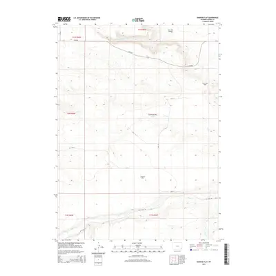
2015 Map of Diamond Flat
USGS Topo · Published 2015About this map
Diamond Flat defines the open, high-plains character of this Goshen County landscape as it appeared in 2015. The terrain is marked by significant topographical shifts where the upland flats drop into Lone Tree Canyon and the natural passage at Fox Creek Gap. Water management in this semi-arid environment is evidenced by the Marsh Reservoir Number 2, which captures drainage from Fox Cr in the center of the township. A network of rural corridors, including the primary Lonetree road and Bear Creek Rd, connects the scattered ranchlands. The map traces several vital waterways such as Lone Tree Cr and Bear Cr, illustrating the drainage patterns that have historically dictated the location of homesteads and grazing boundaries across this section of Wyoming.
Find a feature on this map
20 named features on this map. Tap any name to fly to it.
Don’t see what you’re looking for? This feature index may not catch every label — zoom into the map to look around manually.
Map Details
Editions of this 2015 Diamond Flat Map
This is the sole edition of this map. No revisions or reprints were ever made.
Other maps of this area

1899 · Goshen Hole
USGS Topo · 1:125,000

1954 · Cheyenne
USGS Topo · 1:250,000

1958 · Cheyenne
USGS Topo · 1:250,000

1960 · Diamond Flat
USGS Topo · 1:24,000

1960 · Hawk Springs
USGS Topo · 1:24,000

1960 · Needle Rock
USGS Topo · 1:24,000

1960 · Rocky Hollow
USGS Topo · 1:24,000

1960 · Kessler Gap
USGS Topo · 1:24,000

1960 · Meriden
USGS Topo · 1:24,000

1963 · Y B O Canyon
USGS Topo · 1:24,000