
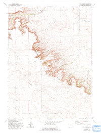
1963 Map of Y B O Canyon
USGS Topo · Published 1967About this map
The Goshen Hole Rim forms a dramatic topographical boundary across this portion of southeastern Wyoming, separating the elevated Iowa Center Flats from the complex drainage systems below. This 1963 field-checked survey highlights a series of deeply incised canyons that cut through the rim, including Barns Canyon, Sawmill Canyon, and the central YBO Canyon. These geographic features dictate the placement of ranching operations and water sources in an otherwise arid landscape. Scattered ranch sites such as Werner Ranch near Elder Creek and the Bogville Ranch on Corn Creek illustrate the historical reliance on these scarce waterways. The map also traces a network of unimproved dirt roads and light-duty paths that navigate the breaks in the rim, connecting isolated livestock operations to the broader Goshen County region.
Find a feature on this map
22 named features on this map. Tap any name to fly to it.
Don’t see what you’re looking for? This feature index may not catch every label — zoom into the map to look around manually.
Map Details
Editions of this 1963 Y B O Canyon Map
2 editions found
Other maps of this area

1899 · Goshen Hole
USGS Topo · 1:125,000

1954 · Cheyenne
USGS Topo · 1:250,000

1958 · Cheyenne
USGS Topo · 1:250,000

1960 · Veteran
USGS Topo · 1:24,000

1960 · Diamond Flat
USGS Topo · 1:24,000

1960 · Needle Rock
USGS Topo · 1:24,000
1963 · Dickinson Hill
USGS Topo · 1:24,000

1963 · C S Ranch
USGS Topo · 1:24,000

1963 · Klutz Canyon
USGS Topo · 1:24,000
1963 · Glomill Reservoir
USGS Topo · 1:24,000