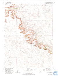
1963 Map of Y B O Canyon
USGS Topo · Published 1993About this map
Goshen Hole Rim defines the dramatic geological shift in this portion of Goshen County, where the high plains break away into a complex system of drainage and erosional features. The terrain is dominated by a series of deep cuts including YBO Canyon, Sawmill Canyon, and Little Josh Canyon, which funnel water toward the lower elevations. Scattered throughout this arid landscape are vital water sources labeled simply as Springs, supporting the livestock operations that anchor the area's economy. Highlighting the settlement patterns of the mid-20th century, the map identifies established grazing hubs such as Werner Ranch in the north and Smith Ranch further south. Below the rim, the expanse of the Iowa Center Flats illustrates the transition from the rugged canyonlands to the more level grazing and agricultural lands that characterize the interior of the Goshen Hole.
Find a feature on this map
18 named features on this map. Tap any name to fly to it.
Don’t see what you’re looking for? This feature index may not catch every label — zoom into the map to look around manually.
Map Details
Editions of this 1963 Y B O Canyon Map
2 editions found
Other maps of this area

1899 · Goshen Hole
USGS Topo · 1:125,000

1954 · Cheyenne
USGS Topo · 1:250,000

1958 · Cheyenne
USGS Topo · 1:250,000

1960 · Veteran
USGS Topo · 1:24,000

1960 · Diamond Flat
USGS Topo · 1:24,000

1960 · Needle Rock
USGS Topo · 1:24,000
1963 · Dickinson Hill
USGS Topo · 1:24,000

1963 · C S Ranch
USGS Topo · 1:24,000

1963 · Y B O Canyon
USGS Topo · 1:24,000

1963 · Klutz Canyon
USGS Topo · 1:24,000