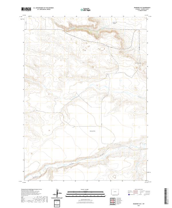
2021 Map of Diamond Flat
USGS Topo · Published 2021About this map
Diamond Flat occupies the central expanse of this high-elevation terrain in Goshen County, where the landscape is defined by the drainages of Fox Cr and Lone Tree Cr. This 2021 survey illustrates a quiet, rural portion of Wyoming primarily organized by the Public Land Survey System, with grid lines for township and range boundaries such as t20n r63w and t19n r63w marking the territory. The topography is interrupted by significant landmarks like the Lone Tree Canyon in the north and the Fox Creek Gap to the east. Transportation is limited to a network of local routes including Bear Creek Rd and Co RD 25, which serve the scattered ranching interests of the region. The map highlights the vital role of seasonal and permanent water sources, tracing the paths of Bear Cr and Dater Cr as they navigate the breaks in the plateau.
Find a feature on this map
19 named features on this map. Tap any name to fly to it.
Don’t see what you’re looking for? This feature index may not catch every label — zoom into the map to look around manually.
Map Details
Editions of this 2021 Diamond Flat Map
This is the sole edition of this map. No revisions or reprints were ever made.
Other maps of this area

1899 · Goshen Hole
USGS Topo · 1:125,000

1954 · Cheyenne
USGS Topo · 1:250,000

1958 · Cheyenne
USGS Topo · 1:250,000

1960 · Diamond Flat
USGS Topo · 1:24,000

1960 · Hawk Springs
USGS Topo · 1:24,000

1960 · Needle Rock
USGS Topo · 1:24,000

1960 · Rocky Hollow
USGS Topo · 1:24,000

1960 · Kessler Gap
USGS Topo · 1:24,000

1960 · Meriden
USGS Topo · 1:24,000

1963 · Y B O Canyon
USGS Topo · 1:24,000