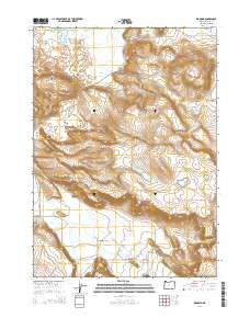
2014 Map of Diamond
USGS Topo · Published 2014About this map
Diamond sits at the base of a dramatic geological transition in Harney County, where the volcanic features of Diamond Craters meet the expansive ranching land of Diamond Valley. The settlement is a hub for a network of remote corridors, including Lava Bed Rd and the Diamond Loop Back Country Bywy, reflecting the region's history as a rugged outpost in the Oregon high desert. Water management is a defining characteristic of this landscape, evidenced by the presence of Highline Ditch, Diamond Canal, and Swamp Cr, which support agricultural activity in Happy Valley and the surrounding flats.
Find a feature on this map
29 named features on this map. Tap any name to fly to it.
Don’t see what you’re looking for? This feature index may not catch every label — zoom into the map to look around manually.
Map Details
Editions of this 2014 Diamond Map
This is the sole edition of this map. No revisions or reprints were ever made.
Other maps of this area

1955 · Burns
USGS Topo · 1:250,000

1955 · Adel
USGS Topo · 1:250,000

1957 · Adel
USGS Topo · 1:250,000

1958 · Burns
USGS Topo · 1:250,000

1958 · Adel
USGS Topo · 1:250,000

1959 · Burns
USGS Topo · 1:250,000

1962 · Adel
USGS Topo · 1:250,000

1967 · Happy Valley
USGS Topo · 1:24,000

1967 · Krumbo Reservoir
USGS Topo · 1:24,000

1967 · Jackass Butte NE
USGS Topo · 1:24,000