
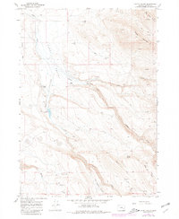
1967 Map of Happy Valley
USGS Topo · Published 1972About this map
Happy Valley is defined by a series of ranching landmarks and deep creek drainages in Harney County, Oregon. The landscape shows the established footprint of the Smyth Ranch and Riddle Ranch, along with several namesake water features such as Smyth Creek and Riddle Creek. High elevations are dominated by the volcanic forms of Riddle Mountain and Big Hill, while the lower terrain reveals functional sites like The Lambing Ground and Fisher Flat. Historical evidence of human activity is recorded through labels for Ruins, Pictographs, and the Smyth Cem. Managed water access is critical here, represented by Smyth Reservoir and various family-named wells like Thompson Well and Paul Well, reflecting the necessity of reliable springs for survival in this high-desert environment.
Find a feature on this map
30 named features on this map. Tap any name to fly to it.
Don’t see what you’re looking for? This feature index may not catch every label — zoom into the map to look around manually.
Map Details
Editions of this 1967 Happy Valley Map
2 editions found
Other maps of this area

1955 · Burns
USGS Topo · 1:250,000

1955 · Adel
USGS Topo · 1:250,000

1957 · Adel
USGS Topo · 1:250,000

1958 · Burns
USGS Topo · 1:250,000

1958 · Adel
USGS Topo · 1:250,000

1959 · Burns
USGS Topo · 1:250,000

1962 · Adel
USGS Topo · 1:250,000

1967 · Barton Lake
USGS Topo · 1:24,000

1967 · Diamond
USGS Topo · 1:24,000

1967 · Adobe Flat
USGS Topo · 1:24,000