
1967 Map of Barton Lake
USGS Topo · Published 1972About this map
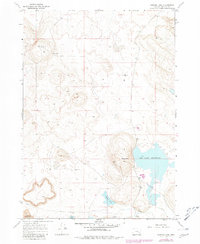
Barton Ranch sits within a landscape defined by volcanic geology and ephemeral water in Harney County, Oregon. This late-1960s survey documents a region where ranching and water management are critical to survival, centered around features like the Dry Lake Reservoir and the drainage of Riddle Creek. The southwestern portion of the map showcases the unique topography of the Diamond Craters, a stark contrast to the flatter terrain surrounding White Lake. Because of the arid climate, several specific water sources are named, providing important landmarks for local history, including Beckley Well, Voltage Wells, and the Barton Lake Well. These scattered wells and water tanks suggest a network of rangeland improvements essential for the cattle operations that have historically characterized this remote section of the High Desert.
Find a feature on this map
12 named features on this map. Tap any name to fly to it.
Don’t see what you’re looking for? This feature index may not catch every label — zoom into the map to look around manually.
Map Details
Editions of this 1967 Barton Lake Map
2 editions found
Other maps of this area

1955 · Burns
USGS Topo · 1:250,000

1958 · Burns
USGS Topo · 1:250,000

1959 · Burns
USGS Topo · 1:250,000

1959 · Lawen
USGS Topo · 1:62,500

1960 · Crane
USGS Topo · 1:62,500

1967 · Happy Valley
USGS Topo · 1:24,000

1967 · Jackass Butte NE
USGS Topo · 1:24,000
1967 · Diamond Swamp
USGS Topo · 1:24,000

1967 · Diamond
USGS Topo · 1:24,000

1967 · Adobe Flat
USGS Topo · 1:24,000