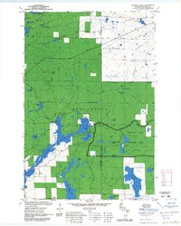
1971 Map of Diamond Lake
USGS Topo · Published 1985About this map
Chequamegon National Forest encompasses the vast majority of this landscape, characterized by a dense concentration of glacial lakes and springs within the Hayward and Washburn ranger districts. Significant water bodies like Lake Owen and Diamond Lake dominate the southern half, while the northern reaches feature a network of smaller basins including Esox Lake, Overby Lake, and Cisco Lake.
Find a feature on this map
46 named features on this map. Tap any name to fly to it.
Don’t see what you’re looking for? This feature index may not catch every label — zoom into the map to look around manually.
Map Details
Editions of this 1971 Diamond Lake Map
3 editions found
Other maps of this area

1943 · Namekagon Lake
USGS Topo · 1:48,000

1944 · Drummond
USGS Topo · 1:48,000

1944 · Grandview
USGS Topo · 1:48,000

1944 · Hayward
USGS Topo · 1:48,000

1945 · Namekagon Lake
USGS Topo · 1:48,000

1947 · Drummond
USGS Topo · 1:48,000

1947 · Grandview
USGS Topo · 1:48,000

1953 · Ashland
USGS Topo · 1:250,000

1958 · Ashland
USGS Topo · 1:250,000
1971 · Delta
USGS Topo · 1:24,000