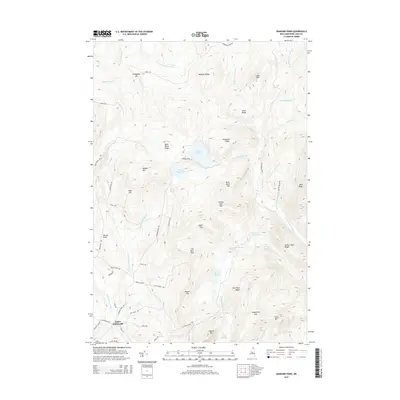
2015 Map of Diamond Pond
USGS Topo · Published 2015About this map
Upper Kidderville serves as the primary point of settlement in this northern New Hampshire landscape, where the headwaters of the E Br Mohawk River and W Br Mohawk River begin their descent. The terrain is defined by a dense network of high ridges and peaks, including the strikingly named Sanguinary Mtn and Tumble Dick Mtn. A significant cluster of alpine water bodies, most notably Diamond Pond and Little Diamond Pond, highlights the area's glacial geography. To the east, the Swift Diamond River carves through the forest, fed by numerous streams like Nathan Pond Brook and Keyser Brook. The road network, including the curiously named Lost Nation Rd, reflects a history of remote access to timber and high-country recreation. Local family names are etched into the geography at places like Harvey Swell and Keazer Mtn, grounding the map in the region's human history.
Find a feature on this map
63 named features on this map. Tap any name to fly to it.
Don’t see what you’re looking for? This feature index may not catch every label — zoom into the map to look around manually.
Map Details
Editions of this 2015 Diamond Pond Map
This is the sole edition of this map. No revisions or reprints were ever made.
Other maps of this area

1925 · Indian Stream
USGS Topo · 1:48,000

1926 · Indian Stream
USGS Topo · 1:62,500

1927 · Indian Stream
USGS Topo · 1:62,500

1927 · Second Lake
USGS Topo · 1:62,500

1930 · Dixville
USGS Topo · 1:62,500

1930 · Errol
USGS Topo · 1:62,500

1932 · Second Lake
USGS Topo · 1:62,500

1933 · Dixville
USGS Topo · 1:62,500

1934 · Dixville
USGS Topo · 1:62,500

1934 · Errol
USGS Topo · 1:62,500