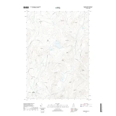
2018 Map of Diamond Pond
USGS Topo · Published 2018About this map
Upper Kidderville sits at the southern edge of this high-elevation landscape, where the E Br Mohawk River and W Br Mohawk River begin their descent. The area is defined by a series of prominent peaks and ridges, including the strikingly named Sanguinary Mtn, Tumble Dick Mtn, and Van Dyck Mtn. Central to the terrain are Diamond Pond and Little Diamond Pond, which anchor a complex network of seasonal streams and mountain brooks such as Swift Diamond River and Sugar Hill Brook. Local travel is dictated by the ridgelines, with roads like Lost Nation Rd and Whipple Ridge Rd providing access to these upland stretches. The naming conventions, from Harvey Swell to Cave Mtn, reflect a long-standing local vernacular for the specific contours of the Coos County backcountry.
Find a feature on this map
68 named features on this map. Tap any name to fly to it.
Don’t see what you’re looking for? This feature index may not catch every label — zoom into the map to look around manually.
Map Details
Editions of this 2018 Diamond Pond Map
This is the sole edition of this map. No revisions or reprints were ever made.
Other maps of this area

1925 · Indian Stream
USGS Topo · 1:48,000

1926 · Indian Stream
USGS Topo · 1:62,500

1927 · Indian Stream
USGS Topo · 1:62,500

1927 · Second Lake
USGS Topo · 1:62,500

1930 · Dixville
USGS Topo · 1:62,500

1930 · Errol
USGS Topo · 1:62,500

1932 · Second Lake
USGS Topo · 1:62,500

1933 · Dixville
USGS Topo · 1:62,500

1934 · Dixville
USGS Topo · 1:62,500

1934 · Errol
USGS Topo · 1:62,500