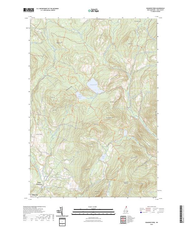
2024 Map of Diamond Pond
USGS Topo · Published 2024About this map
Kidderville and Upper Kidderville sit at the southwestern edge of a high-country landscape defined by complex water systems and dramatic peaks. The area serves as a significant drainage basin, where the Mohawk River and its branches meet the southward-flowing Swift Diamond River. To the north, the terrain rises toward Diamond Pond and Little Diamond Pond, surrounded by an extensive network of ridges including Diamond Ridge and Dead Water Ridge.
Find a feature on this map
74 named features on this map. Tap any name to fly to it.
Don’t see what you’re looking for? This feature index may not catch every label — zoom into the map to look around manually.
Map Details
Editions of this 2024 Diamond Pond Map
This is the sole edition of this map. No revisions or reprints were ever made.
Other maps of this area

1925 · Indian Stream
USGS Topo · 1:48,000

1926 · Indian Stream
USGS Topo · 1:62,500

1927 · Indian Stream
USGS Topo · 1:62,500

1927 · Second Lake
USGS Topo · 1:62,500

1930 · Dixville
USGS Topo · 1:62,500

1930 · Errol
USGS Topo · 1:62,500

1932 · Second Lake
USGS Topo · 1:62,500

1933 · Dixville
USGS Topo · 1:62,500

1934 · Dixville
USGS Topo · 1:62,500

1934 · Errol
USGS Topo · 1:62,500