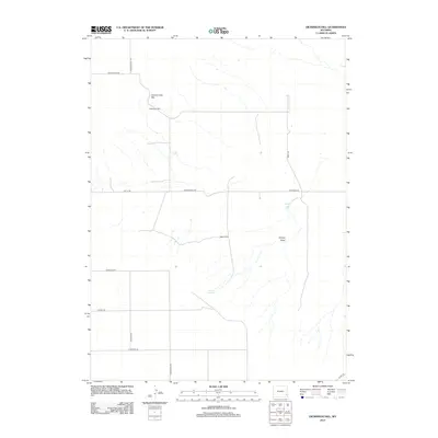
2012 Map of Dickinson Hill
USGS Topo · Published 2012About this map
Goshen Hole Rim defines the dramatic topography of this high plains landscape in Goshen County. This 2012 survey reveals a sparse network of ranching and access roads, including Notch Rd and Dickerson Rd, which traverse the open range. The area is characterized by scattered water sources vital to local agriculture, such as Forney Springs and the seasonal drainage of Forney Draw. The presence of the Baker Ranch serves as a primary marker of human settlement in this expansive terrain. Rising above the surrounding flats, Dickinson Hill provides a prominent landmark for navigation along the local road system, which includes Bordeaux Rd and Goshen Hole Rd. This map captures the modern layout of rural land parcels and the persistent infrastructure of Wyoming's ranching heritage.
Find a feature on this map
17 named features on this map. Tap any name to fly to it.
Don’t see what you’re looking for? This feature index may not catch every label — zoom into the map to look around manually.
Map Details
Editions of this 2012 Dickinson Hill Map
This is the sole edition of this map. No revisions or reprints were ever made.
Other maps of this area

1896 · Hartville
USGS Topo · 1:125,000

1901 · Hartville
USGS Topo · 1:125,000

1950 · Rockeagle
USGS Topo · 1:24,000

1951 · Antelope Gap
USGS Topo · 1:24,000

1951 · Eagles Nest
USGS Topo · 1:24,000

1953 · Chugwater
USGS Topo · 1:24,000

1953 · Bordeaux
USGS Topo · 1:24,000

1954 · Torrington
USGS Topo · 1:250,000

1954 · Cheyenne
USGS Topo · 1:250,000

1958 · Cheyenne
USGS Topo · 1:250,000