
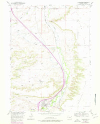
1953 Map of Chugwater
USGS Topo · Published 1954About this map
Chugwater serves as the focal point of this mid-century ranching and transport corridor, where the Colorado and Southern (Burlington) railroad tracks parallel the winding course of Chugwater Creek. This period survey documents the infrastructure of the Missouri River Basin development program, including the prominent Grain Elevators, Water Tank, and Gasoline Tanks that supported the local agricultural economy. The landscape is defined by the sharp transition from the elevated Chugwater Flats and Slater Flats down into the creek valley, where irrigation via the Home Ditch and Ramsey Ditch allowed for cultivation. Scattered windmills across the high ground, such as those near Lathrum Spring and Chimney Rock, highlight the vital importance of water management in this high-plains environment. Smaller sidings and stops like Slater and Swan mark the rail line's path through the northern reaches of the quadrangle.
Find a feature on this map
22 named features on this map. Tap any name to fly to it.
Don’t see what you’re looking for? This feature index may not catch every label — zoom into the map to look around manually.
Map Details
Editions of this 1953 Chugwater Map
2 editions found
Other maps of this area

1953 · Double L Ranch
USGS Topo · 1:24,000

1953 · Ferguson Corner
USGS Topo · 1:24,000

1953 · Bordeaux
USGS Topo · 1:24,000

1954 · Cheyenne
USGS Topo · 1:250,000

1958 · Cheyenne
USGS Topo · 1:250,000

1962 · Bristol Ridge NE
USGS Topo · 1:24,000
1962 · Whitcomb Hill
USGS Topo · 1:24,000
1963 · Dickinson Hill
USGS Topo · 1:24,000

1963 · C S Ranch
USGS Topo · 1:24,000

1963 · Klutz Canyon
USGS Topo · 1:24,000