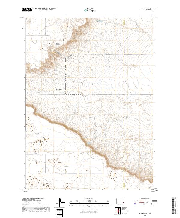
2021 Map of Dickinson Hill
USGS Topo · Published 2021About this map
Dickinson Hill rises as a prominent landmark on this high plains landscape along the county line between Platte and Goshen counties. The terrain is defined by the dramatic escarpment of the Goshen Hole Rim, which cuts diagonally across the quadrangle, separating the elevated northern plateau from the lower drainage basins to the south. This geological boundary dictates the local water patterns, with Forney Springs and the seasonal path of Forney Draw emerging from the base of the rim.
Find a feature on this map
22 named features on this map. Tap any name to fly to it.
Don’t see what you’re looking for? This feature index may not catch every label — zoom into the map to look around manually.
Map Details
Editions of this 2021 Dickinson Hill Map
This is the sole edition of this map. No revisions or reprints were ever made.
Other maps of this area

1896 · Hartville
USGS Topo · 1:125,000

1901 · Hartville
USGS Topo · 1:125,000

1950 · Rockeagle
USGS Topo · 1:24,000

1951 · Antelope Gap
USGS Topo · 1:24,000

1951 · Eagles Nest
USGS Topo · 1:24,000

1953 · Chugwater
USGS Topo · 1:24,000

1953 · Bordeaux
USGS Topo · 1:24,000

1954 · Torrington
USGS Topo · 1:250,000

1954 · Cheyenne
USGS Topo · 1:250,000

1958 · Cheyenne
USGS Topo · 1:250,000