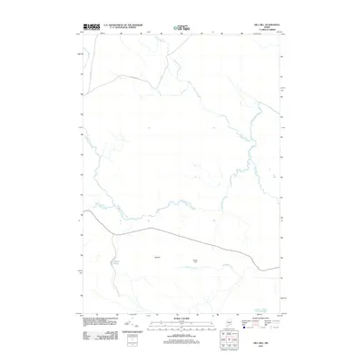
2011 Map of Dill Hill
USGS Topo · Published 2011About this map
Baskahegan Stream winds through this interior Maine landscape, defining the drainage patterns of a region dominated by low-lying wetlands and isolated peaks. The terrain is anchored by the modest elevations of Dill Hill and Horse Hill, which rise above a network of smaller tributaries including Pleasant Brook, Horsehill Brook, and Lindsey Brook. This 2011 survey reflects a sparsely populated area where the human footprint is limited to a handful of gravel roads and rural tracks, such as Atlas Rd and Schillinger Rd. Significant water bodies like Dipper Pond and the edge of Trout Lake provide essential landmarks in a territory where natural hydrography dictated early access and land use. The presence of Dipper Pond Rd suggests localized recreational or logging access, characteristic of northern Penobscot County's timberlands.
Find a feature on this map
12 named features on this map. Tap any name to fly to it.
Don’t see what you’re looking for? This feature index may not catch every label — zoom into the map to look around manually.
Map Details
Editions of this 2011 Dill Hill Map
This is the sole edition of this map. No revisions or reprints were ever made.
Other maps of this area

1931 · Springfield
USGS Topo · 1:48,000

1934 · Springfield
USGS Topo · 1:62,500

1940 · Danforth
USGS Topo · 1:62,500

1941 · Danforth
USGS Topo · 1:62,500

1941 · Scraggly Lake
USGS Topo · 1:62,500

1941 · Wytopitlock
USGS Topo · 1:62,500

1943 · Danforth
USGS Topo · 1:62,500

1943 · Wytopitlock
USGS Topo · 1:62,500

1944 · Scraggly Lake
USGS Topo · 1:62,500

1954 · Millinocket
USGS Topo · 1:250,000