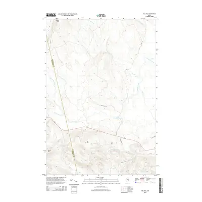
2014 Map of Dill Hill
USGS Topo · Published 2014About this map
Stetson Mtn and Bowers Mtn anchor the high ground in this section of Maine, where the landscape is defined by its complex network of waterways and timber-management roads. The winding course of Baskahegan Stream moves through the center of the sheet, joined by smaller tributaries like Pleasant Brook and Lindsey Brook. The topography is punctuated by several prominent rises, including Dill Hill and Horse Hill, which overlook isolated water bodies such as Dipper Pond and Trout Lake.
Find a feature on this map
23 named features on this map. Tap any name to fly to it.
Don’t see what you’re looking for? This feature index may not catch every label — zoom into the map to look around manually.
Map Details
Editions of this 2014 Dill Hill Map
This is the sole edition of this map. No revisions or reprints were ever made.
Other maps of this area

1931 · Springfield
USGS Topo · 1:48,000

1934 · Springfield
USGS Topo · 1:62,500

1940 · Danforth
USGS Topo · 1:62,500

1941 · Danforth
USGS Topo · 1:62,500

1941 · Scraggly Lake
USGS Topo · 1:62,500

1941 · Wytopitlock
USGS Topo · 1:62,500

1943 · Danforth
USGS Topo · 1:62,500

1943 · Wytopitlock
USGS Topo · 1:62,500

1944 · Scraggly Lake
USGS Topo · 1:62,500

1954 · Millinocket
USGS Topo · 1:250,000