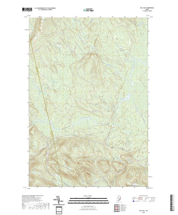
2024 Map of Dill Hill
USGS Topo · Published 2024About this map
Baskahegan Stream dominates this Maine landscape, winding through a complex network of wetlands and wooded highlands along the border of Washington and Penobscot counties. The topography is defined by significant rises such as Stetson Mtn, Bowers Mtn, and the central Dill Hill. These peaks overlook a watery lowland where Big Bog and Black Cat Rips indicate a wilderness characterized by slow-moving water and seasonal drainage.
Find a feature on this map
25 named features on this map. Tap any name to fly to it.
Don’t see what you’re looking for? This feature index may not catch every label — zoom into the map to look around manually.
Map Details
Editions of this 2024 Dill Hill Map
This is the sole edition of this map. No revisions or reprints were ever made.
Other maps of this area

1931 · Springfield
USGS Topo · 1:48,000

1934 · Springfield
USGS Topo · 1:62,500

1940 · Danforth
USGS Topo · 1:62,500

1941 · Danforth
USGS Topo · 1:62,500

1941 · Scraggly Lake
USGS Topo · 1:62,500

1941 · Wytopitlock
USGS Topo · 1:62,500

1943 · Danforth
USGS Topo · 1:62,500

1943 · Wytopitlock
USGS Topo · 1:62,500

1944 · Scraggly Lake
USGS Topo · 1:62,500

1954 · Millinocket
USGS Topo · 1:250,000