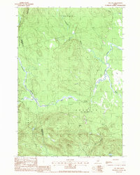
1988 Map of Dill Hill
USGS Topo · Published 1988About this map
Baskahegan Stream and its numerous tributaries dominate this timberland landscape in the late 1980s, marking the boundary between Penobscot and Washington counties. This interior Maine terrain is defined by low peaks like Dill Hill and Bowers Mtn and the intricate drainage of the Alder Brook Bog. The map details the transition from the flowing waters of Big Baskahegan Stream to the slow-moving Middle Deadwater, illustrating the hydrological complexity of the region before any major modern development altered these traditional logging lands. Local elevations like Horse Hill and Stetson Mtn provide the high ground above the saturated lowlands of Deadwater Stream and Horse Brook. This provisional survey preserves the wilderness character of Kossuth and Carroll Plantation, showing the area's geography as it was recorded during aerial photography in 1984.
Find a feature on this map
22 named features on this map. Tap any name to fly to it.
Don’t see what you’re looking for? This feature index may not catch every label — zoom into the map to look around manually.
Map Details
Editions of this 1988 Dill Hill Map
This is the sole edition of this map. No revisions or reprints were ever made.
Other maps of this area

1931 · Springfield
USGS Topo · 1:48,000

1934 · Springfield
USGS Topo · 1:62,500

1940 · Danforth
USGS Topo · 1:62,500

1941 · Danforth
USGS Topo · 1:62,500

1941 · Scraggly Lake
USGS Topo · 1:62,500

1941 · Wytopitlock
USGS Topo · 1:62,500

1943 · Danforth
USGS Topo · 1:62,500

1943 · Wytopitlock
USGS Topo · 1:62,500

1944 · Scraggly Lake
USGS Topo · 1:62,500

1954 · Millinocket
USGS Topo · 1:250,000