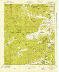
1947 Map of Dillard
USGS Topo · Published 1947About this map
Clayton and Dillard anchor this 1947 topographical study at the border of the Nantahala National Forest and Chattahoochee National Forest. The landscape is defined by the sharp transition between the river valleys and the Blue Ridge Divide, where the Tallulah Falls RR snakes through the narrow gap between Mountain City and Dillard. This era shows a community deeply tied to its mountain environment, with numerous small churches and family-named landmarks like Betty Creek Ch, Taylor Chapel, and the Wesley Chapel Cem. Resource extraction and local industry are evidenced by the Queen Mine, Dickerson Mill, and Kirby Mill, while the presence of the Rabun Gap Nacoochee Sch and Camp Dixie indicates the area's role as an educational and recreational hub in the postwar years. The complex drainage of the Little Tennessee River and Tallulah River systems highlights the geographic importance of this mountain pass.
Find a feature on this map
113 named features on this map. Tap any name to fly to it.
Don’t see what you’re looking for? This feature index may not catch every label — zoom into the map to look around manually.
Map Details
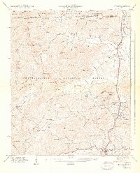
Editions of this 1947 Dillard Map
2 editions found
Other maps of this area

1886 · Dahlonega
USGS Topo · 1:125,000

1886 · Walhalla
USGS Topo · 1:125,000

1891 · Cowee
USGS Topo · 1:125,000

1892 · Dahlonega
USGS Topo · 1:125,000

1892 · Walhalla
USGS Topo · 1:125,000

1896 · Walhalla
USGS Topo · 1:125,000

1896 · Dahlonega
USGS Topo · 1:125,000

1897 · Cowee
USGS Topo · 1:125,000

1903 · Dahlonega
USGS Topo · 1:125,000

1907 · Cowee
USGS Topo · 1:125,000