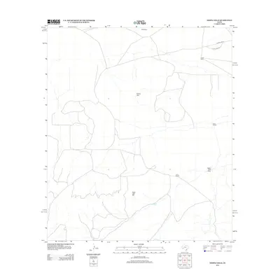
2012 Map of Dimple Hills
USGS Topo · Published 2012About this map
Dimple Hills and Sugar Loaf Mtn define this section of Pecos County, where the high desert terrain is marked by essential water infrastructure and isolated ranching outposts. This 2012 survey illustrates a landscape where survival and industry are tied to features like Eighty Tank and the seasonal drainage of Eighty Tank Draw. The map records the sparse network of ranch roads, such as Cupolo Peak Rd and Longfellow Rd, which connect remote sites like League Ranch and the open expanses of W B Flats. The presence of named landmarks such as Gurley Windmill and Peters Windmill highlights the vital role of groundwater extraction in this arid environment, providing clear points of interest for those studying the history of West Texas land use and ranching genealogy.
Find a feature on this map
11 named features on this map. Tap any name to fly to it.
Don’t see what you’re looking for? This feature index may not catch every label — zoom into the map to look around manually.
Map Details
Editions of this 2012 Dimple Hills Map
This is the sole edition of this map. No revisions or reprints were ever made.
Other maps of this area

1920 · Longfellow
USGS Topo · 1:125,000

1920 · Marathon
USGS Topo · 1:62,500

1921 · Marathon
USGS Topo · 1:62,500

1923 · Hess Canyon
USGS Topo · 1:62,500

1954 · Fort Stockton
USGS Topo · 1:250,000

1958 · Fort Stockton
USGS Topo · 1:250,000

1968 · Housetop Mountains
USGS Topo · 1:24,000

1968 · Cap Rock Butte
USGS Topo · 1:24,000

1968 · Marathon Gap
USGS Topo · 1:24,000

1968 · Dimple Hills
USGS Topo · 1:24,000