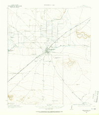
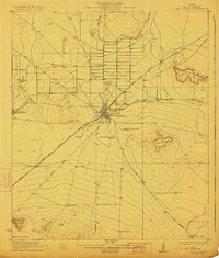
1958 Map of Fort Stockton
USGS Topo · Published 1958About this map
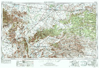
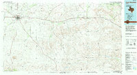
Fort Stockton serves as the central hub of this Trans-Pecos landscape, situated where the Old Spanish Trail meets a network of ranching roads and early highways. The 1950s terrain is defined by massive limestone uplands, including Sherbino Mesa and the Glass Mountains, while life clings to reliable water sources like Balmorhea Lake and Comanche Creek. This era reveals a region dominated by extensive ranching and the arrival of petroleum infrastructure, as seen in the sprawling network of windmills and pump stations. Transport corridors are vital to these isolated communities; the Texas and New Orleans RR and Southern Pacific tracks parallel the ancient routes through Alpine and Marathon. This survey offers a clear view of the high-desert geography before modern development, detailing the relationship between the dramatic mountain ranges like the Santiago Mountains and the sparse settlements that sustain this vast Texas frontier.
Find a feature on this map
40 named features on this map. Tap any name to fly to it.
Don’t see what you’re looking for? This feature index may not catch every label — zoom into the map to look around manually.
Map Details
Editions of this 1958 Fort Stockton Map
This is the sole edition of this map. No revisions or reprints were ever made.
Historical Maps of Fort Stockton Through Time
6 maps found