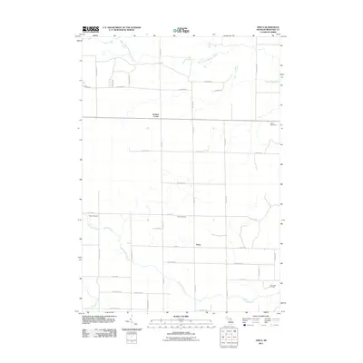
2011 Map of Dinca
USGS Topo · Published 2011About this map
West Branch Muskegon River meanders across the northern section of this Missaukee County landscape, illustrating a rural Michigan geography defined by its creek systems and section-line roads. The small settlement of Dinca and the junction at Keelans Corner serve as primary landmarks in a region where the agricultural and extractive economies intersect. To the southeast, the Butterfield Oil Field indicates the local industrial activity, while the Merritt Speedway provides a distinct modern landmark among the fields. For those researching family history in Aetna Township, the map identifies both the Reeder Cemetery and Aetna Cemetery. The drainage patterns of Butterfield Creek and Mosquito Creek dominate the southern half of the sheet, shaping the placement of local routes such as S Turnerville Rd and S 7 Mile Rd.
Find a feature on this map
41 named features on this map. Tap any name to fly to it.
Don’t see what you’re looking for? This feature index may not catch every label — zoom into the map to look around manually.
Map Details
Editions of this 2011 Dinca Map
This is the sole edition of this map. No revisions or reprints were ever made.
Other maps of this area

1954 · Traverse City
USGS Topo · 1:250,000

1956 · Houghton Lake
USGS Topo · 1:62,500

1956 · Lake City
USGS Topo · 1:62,500

1957 · Harrison
USGS Topo · 1:62,500

1957 · Marion
USGS Topo · 1:62,500

1958 · Traverse City
USGS Topo · 1:250,000

1983 · Cadillac
USGS Topo · 1:100,000

1983 · Moddersville
USGS Topo · 1:25,000

1983 · Stittsville
USGS Topo · 1:24,000

1983 · Lake City
USGS Topo · 1:25,000
Featured Places
- Aetna Township, MI
- Keelans Corner, MI
- Riverside Township, MI
- West Branch Township, MI
- Reeder Township, MI