
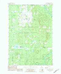
1983 Map of Moddersville
USGS Topo · Published 1984About this map
The Moddersville community and surrounding wetlands define this northern Michigan landscape during the early 1980s. Local civic and social life is anchored by the Townhall, the Reformed Ch, and the West Moddersville Cem, while the industrial presence of an Oil and Gas Storage Field appears near the border of Winterfield and Summerfield. The terrain is characterized by a complex network of marshes and swamps, including the Vanderwal Swamp, Spitzbergen Marsh, and Rush Swamp, which feed into the winding Muskegon River.
Find a feature on this map
36 named features on this map. Tap any name to fly to it.
Don’t see what you’re looking for? This feature index may not catch every label — zoom into the map to look around manually.
Map Details
Editions of this 1983 Moddersville Map
2 editions found
Other maps of this area

1954 · Traverse City
USGS Topo · 1:250,000

1956 · Houghton Lake
USGS Topo · 1:62,500

1956 · Lake City
USGS Topo · 1:62,500

1957 · Harrison
USGS Topo · 1:62,500

1957 · Marion
USGS Topo · 1:62,500

1958 · Traverse City
USGS Topo · 1:250,000

1983 · Cadillac
USGS Topo · 1:100,000
1983 · Temple
USGS Topo · 1:25,000
1983 · Dinca
USGS Topo · 1:25,000
1983 · Falmouth
USGS Topo · 1:25,000