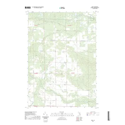
2023 Map of Dinca
USGS Topo · Published 2023About this map
Dinca sits at the heart of this Missaukee County landscape, where the rural grid is defined by a network of drainage and wetlands. The topography is marked by the winding course of the West Branch Muskegon River in the northeast and the multiple branches of Butterfield Creek that cut across the southern sections. This area of Michigan is characterized by low-lying marshlands, notably Seanlan Marsh and Seafuse Marsh, which significantly influence the road patterns and land use. Local history and genealogy are anchored by the presence of Aetna Cem and Reeder Cem, while the northern reach includes the Farm Service Agency Interest of Michigan lands. The map details a transition from the agricultural or conserved marshlands to the timbered areas surrounding Mosquito Creek.
Find a feature on this map
36 named features on this map. Tap any name to fly to it.
Don’t see what you’re looking for? This feature index may not catch every label — zoom into the map to look around manually.
Map Details
Editions of this 2023 Dinca Map
This is the sole edition of this map. No revisions or reprints were ever made.
Other maps of this area

1954 · Traverse City
USGS Topo · 1:250,000

1956 · Houghton Lake
USGS Topo · 1:62,500

1956 · Lake City
USGS Topo · 1:62,500

1957 · Harrison
USGS Topo · 1:62,500

1957 · Marion
USGS Topo · 1:62,500

1958 · Traverse City
USGS Topo · 1:250,000

1983 · Cadillac
USGS Topo · 1:100,000

1983 · Moddersville
USGS Topo · 1:25,000

1983 · Stittsville
USGS Topo · 1:24,000

1983 · Lake City
USGS Topo · 1:25,000
Featured Places
- Aetna Township, MI
- Forest Township, MI
- Keelans Corner, MI
- Riverside Township, MI
- Clam Union Township, MI