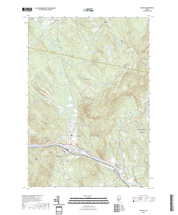
2024 Map of Dixfield
USGS Topo · Published 2024About this map
The Androscoggin River winds through the southern reaches of this region, shaping the development of Dixfield and West Peru. The landscape transitions from the river valley to prominent heights such as Sugarloaf and Holman Mtn, reflecting the varied topography of the Franklin and Oxford county line. Numerous small watercourses, including Webb River and Aunt Hannah Brook, drain the uplands, while Podunk Pond sits isolated in the northeast. For those researching local history, the map provides precise locations for over ten burial grounds, including the Holman Family Cem and Storer Hill Cem, which often mark the sites of early family homesteads. The road network, featuring Weld St and Main St, connects the valley settlements to smaller hamlets like Dixfield Center and the northern township of Carthage.
Find a feature on this map
99 named features on this map. Tap any name to fly to it.
Don’t see what you’re looking for? This feature index may not catch every label — zoom into the map to look around manually.
Map Details
Editions of this 2024 Dixfield Map
This is the sole edition of this map. No revisions or reprints were ever made.
Other maps of this area

1911 · Bryant Pond
USGS Topo · 1:62,500

1911 · Buckfield
USGS Topo · 1:62,500

1913 · Buckfield
USGS Topo · 1:62,500

1914 · Bryant Pond
USGS Topo · 1:62,500

1926 · Dixfield
USGS Topo · 1:62,500

1927 · Rumford
USGS Topo · 1:48,000

1929 · Dixfield
USGS Topo · 1:62,500

1930 · Rumford
USGS Topo · 1:62,500

1942 · Buckfield
USGS Topo · 1:62,500

1942 · Bryant Pond
USGS Topo · 1:62,500