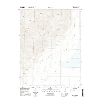
2015 Map of Dixie Hot Springs
USGS Topo · Published 2015About this map
Dixie Hot Springs and the expansive Humboldt Salt Marsh anchor this desert landscape in Dixie Valley. The eastern slopes of the Stillwater Range dominate the topography, cut by numerous drainages including Mississippi Canyon, Hare Canyon, and Cottonwood Canyon. A significant geological feature, the Fault Scarp of 1954, remains visible on the valley floor, providing a literal mark of the region's seismic history. This arid basin is further defined by scattered water sources such as Cold Springs and Eagle Springs. The primary corridor through the area is Dixie Valley Rd, connecting the small settlement of Dixie to the surrounding wilderness. The map reveals the stark relationship between the high peaks, such as Star Peak, and the low-lying alkali flats that characterize this part of Churchill County.
Find a feature on this map
19 named features on this map. Tap any name to fly to it.
Don’t see what you’re looking for? This feature index may not catch every label — zoom into the map to look around manually.
Map Details
Editions of this 2015 Dixie Hot Springs Map
This is the sole edition of this map. No revisions or reprints were ever made.
Other maps of this area

1908 · Carson Sink
USGS Topo · 1:250,000

1910 · Carson Sink
USGS Topo · 1:250,000

1955 · Millett
USGS Topo · 1:250,000

1957 · Reno
USGS Topo · 1:250,000

1959 · Reno
USGS Topo · 1:250,000

1959 · Millett
USGS Topo · 1:250,000

1960 · Reno
USGS Topo · 1:250,000

1966 · Clan Alpine Ranch
USGS Topo · 1:62,500

1966 · Humboldt Salt Marsh
USGS Topo · 1:62,500

1966 · Dixie Hot Springs
USGS Topo · 1:62,500