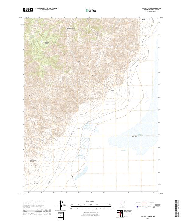
2021 Map of Dixie Hot Springs
USGS Topo · Published 2021About this map
The Stillwater Range dominates this Churchill County landscape, rising sharply above the basin of the Humboldt Salt Marsh. This 2021 survey illustrates the stark geomorphology of the Great Basin, notably preserving the location of the Fault Scarp of 1954, a geological feature resulting from a powerful earthquake sequence that fundamentally altered the local topography. In the lower elevations, the presence of Dixie Hot Springs, Cold Springs, and Dixie Meadows indicates the vital geothermal and hydrological activity that sustains life in this arid valley.
Find a feature on this map
21 named features on this map. Tap any name to fly to it.
Don’t see what you’re looking for? This feature index may not catch every label — zoom into the map to look around manually.
Map Details
Editions of this 2021 Dixie Hot Springs Map
This is the sole edition of this map. No revisions or reprints were ever made.
Other maps of this area

1908 · Carson Sink
USGS Topo · 1:250,000

1910 · Carson Sink
USGS Topo · 1:250,000

1955 · Millett
USGS Topo · 1:250,000

1957 · Reno
USGS Topo · 1:250,000

1959 · Reno
USGS Topo · 1:250,000

1959 · Millett
USGS Topo · 1:250,000

1960 · Reno
USGS Topo · 1:250,000

1966 · Clan Alpine Ranch
USGS Topo · 1:62,500

1966 · Humboldt Salt Marsh
USGS Topo · 1:62,500

1966 · Dixie Hot Springs
USGS Topo · 1:62,500