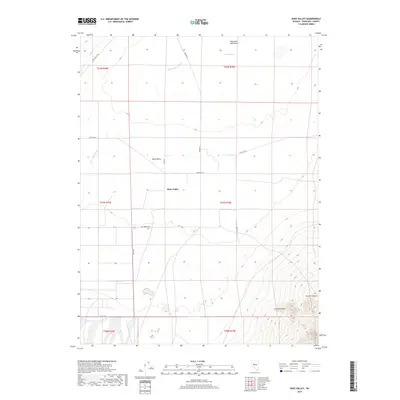
2018 Map of Dixie Valley
USGS Topo · Published 2018About this map
Dixie Valley sits at the heart of this high-desert basin, where a network of rural routes like Settlement Rd, Cattle Rd, and Dixie Valley Rd delineate the open landscape. The terrain is defined by the sharp transition from the flat basin floor, home to the Humboldt Salt Marsh and Dixie Meadows, to the dramatic elevation gains found in Granite Cañon and Grover Canyon to the southeast. Hydrological features such as Dixie Valley Wash and the oddly named Terrell Hole illustrate the drainage patterns of this arid environment. This map reflects the enduring rural character of the region, where legacy land divisions and specialized local roads provide evidence of the area's agricultural and ranching history in the late 2010s.
Find a feature on this map
22 named features on this map. Tap any name to fly to it.
Don’t see what you’re looking for? This feature index may not catch every label — zoom into the map to look around manually.
Map Details
Editions of this 2018 Dixie Valley Map
This is the sole edition of this map. No revisions or reprints were ever made.
Other maps of this area

1908 · Carson Sink
USGS Topo · 1:250,000

1910 · Carson Sink
USGS Topo · 1:250,000

1955 · Millett
USGS Topo · 1:250,000

1957 · Reno
USGS Topo · 1:250,000

1959 · Reno
USGS Topo · 1:250,000

1959 · Millett
USGS Topo · 1:250,000

1960 · Reno
USGS Topo · 1:250,000

1966 · Clan Alpine Ranch
USGS Topo · 1:62,500

1966 · Humboldt Salt Marsh
USGS Topo · 1:62,500

1966 · Dixie Hot Springs
USGS Topo · 1:62,500