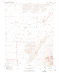
1972 Map of Dixie Valley
USGS Topo · Published 1975About this map
The arid landscape of the Dixie Valley (Depression) is defined by its precarious water resources and vast natural formations, as seen in this 1970s survey. Much of the northern terrain is occupied by the Humboldt Salt Marsh, a basin of Mud and ephemeral springs that give way southward to extensive Sand Dunes. Human presence is sparse but precisely mapped, centered around the Crazy K Ranch and a network of arterial paths including Settlement Road and Dixie Valley Road.
Find a feature on this map
21 named features on this map. Tap any name to fly to it.
Don’t see what you’re looking for? This feature index may not catch every label — zoom into the map to look around manually.
Map Details
Editions of this 1972 Dixie Valley Map
This is the sole edition of this map. No revisions or reprints were ever made.
Other maps of this area

1908 · Carson Sink
USGS Topo · 1:250,000

1910 · Carson Sink
USGS Topo · 1:250,000

1955 · Millett
USGS Topo · 1:250,000

1957 · Reno
USGS Topo · 1:250,000

1959 · Reno
USGS Topo · 1:250,000

1959 · Millett
USGS Topo · 1:250,000

1960 · Reno
USGS Topo · 1:250,000

1966 · Clan Alpine Ranch
USGS Topo · 1:62,500

1966 · Humboldt Salt Marsh
USGS Topo · 1:62,500

1966 · Dixie Hot Springs
USGS Topo · 1:62,500