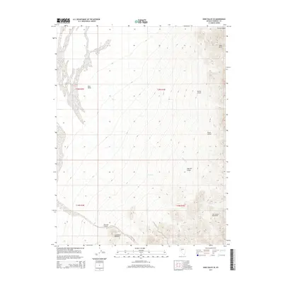
2014 Map of Dixie Valley SE
USGS Topo · Published 2014About this map
The Clan Alpine Mountains dominate this southeastern portion of the Dixie Valley region, presenting a stark landscape defined by dramatic elevation changes. As documented in this 2014 survey, the area is characterized by numerous steep-walled drainages including Paiute Canyon, Dummy Canyon, and Hercules Canyon. These canyons descend from the peaks toward the valley floor, where ephemeral water sources like Sagehen Cr and Horse Cr provide the primary drainage. The terrain transitions from the jagged heights of the Louderback Mountains in the south to the prominent Black Butte in the northeast, illustrating the complex geological folding of the Great Basin. This map captures the region's land divisions across the T20N and T19N ranges, essential for tracing land use and property boundaries in this remote corner of Churchill County.
Find a feature on this map
15 named features on this map. Tap any name to fly to it.
Don’t see what you’re looking for? This feature index may not catch every label — zoom into the map to look around manually.
Map Details
Editions of this 2014 Dixie Valley SE Map
This is the sole edition of this map. No revisions or reprints were ever made.
Other maps of this area

1908 · Carson Sink
USGS Topo · 1:250,000

1910 · Carson Sink
USGS Topo · 1:250,000

1955 · Millett
USGS Topo · 1:250,000

1957 · Reno
USGS Topo · 1:250,000

1959 · Reno
USGS Topo · 1:250,000

1959 · Millett
USGS Topo · 1:250,000

1960 · Reno
USGS Topo · 1:250,000

1966 · Clan Alpine Ranch
USGS Topo · 1:62,500

1969 · Camp Creek Canyon
USGS Topo · 1:24,000

1972 · Pirouette Mtn
USGS Topo · 1:24,000