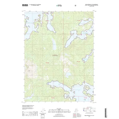
2017 Map of Dixon Entrance D-1 NE
USGS Topo · Published 2017About this map
The coastal wilderness of the Tongass National Forest dominates this landscape on Prince of Wales Island, where the deep inlets and protected coves of the Gulf of Alaska define the shoreline. The geography is marked by significant topographical landmarks such as Bokan Mtn, rising above the intricate network of waterways. Water remains the primary feature of this terrain, characterized by the expansive Kendrick Bay and its West Arm Kendrick Bay, which provide natural harbors shielded by the Kendrick Islands. Moving inland, the map reveals the drainage patterns of the temperate rainforest, including Hessa Lake, Johnson Lake, and the winding path of Perkins Cr. These features illustrate the complex intersection of mountainous island terrain and the North Pacific's jagged coastline, preserved within one of the nation's largest forest reserves.
Find a feature on this map
18 named features on this map. Tap any name to fly to it.
Don’t see what you’re looking for? This feature index may not catch every label — zoom into the map to look around manually.
Map Details
Editions of this 2017 Dixon Entrance D-1 NE Map
This is the sole edition of this map. No revisions or reprints were ever made.
Other maps of this area

1948 · Prince Rupert D-6
USGS Topo · 1:63,360

1948 · Ketchikan A-6
USGS Topo · 1:63,360

1948 · Craig A-1
USGS Topo · 1:63,360

1948 · Dixon Entrance D-1
USGS Topo · 1:63,360

1951 · Prince Rupert
USGS Topo · 1:250,000

1951 · Dixon Entrance
USGS Topo · 1:250,000

1951 · Prince Rupert D-6
USGS Topo · 1:63,360

1952 · Ketchikan
USGS Topo · 1:250,000

1955 · Ketchikan
USGS Topo · 1:250,000

1957 · Craig
USGS Topo · 1:250,000