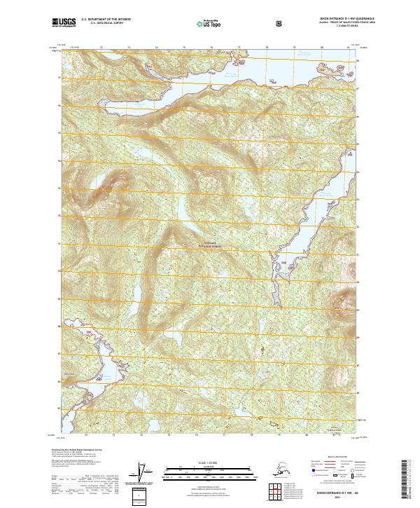
2021 Map of Dixon Entrance D-1 NW
USGS Topo · Published 2021About this map
Prince of Wales Island presents a landscape of deep fjords and steep peaks, defined by the intricate waterways of the Tongass National Forest. The geography is dominated by the complex reach of West Arm Moira Sound and South Arm Moira Sound, which cut deep into the timbered interior. Along the northern coast, Frederick Cove provides a sheltered harbor below rising elevations. This 2021 survey reveals a remote wilderness where land and sea are inextricably linked, particularly evident at Biscuit Lagoon and the narrow passage of The Saitchuck. Topographical landmarks like Bokan Mtn and Biscuit Knob rise sharply above the coastline, serving as fixed points for navigators and foresters in this roadless maritime environment. Small drainages like Perkins Cr drain the high country, illustrating the rugged hydrologic patterns of the Alexander Archipelago.
Find a feature on this map
17 named features on this map. Tap any name to fly to it.
Don’t see what you’re looking for? This feature index may not catch every label — zoom into the map to look around manually.
Map Details
Editions of this 2021 Dixon Entrance D-1 NW Map
This is the sole edition of this map. No revisions or reprints were ever made.
Other maps of this area

1948 · Dixon Entrance D-2
USGS Topo · 1:63,360

1948 · Craig A-1
USGS Topo · 1:63,360

1948 · Dixon Entrance D-1
USGS Topo · 1:63,360

1948 · Craig A-2
USGS Topo · 1:63,360

1951 · Dixon Entrance
USGS Topo · 1:250,000

1951 · Dixon Entrance D-2
USGS Topo · 1:63,360

1951 · Craig A-2
USGS Topo · 1:63,360

1957 · Craig
USGS Topo · 1:250,000

1959 · Dixon Entrance
USGS Topo · 1:250,000
1994 · Dixon Entrance D-1
USGS Topo · 1:63,360