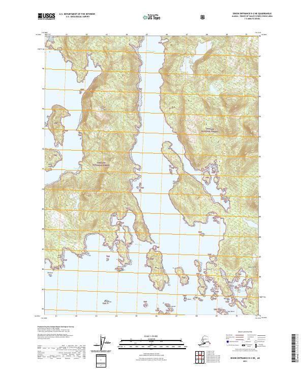
2021 Map of Dixon Entrance D-2 NE
USGS Topo · Published 2021About this map
Prince of Wales Island dominates this coastal landscape within the Tongass National Forest, showing the intricate shoreline where the Pacific meets the Alaskan wilderness. The deep waters of Klakas Inlet separate the main landmass from smaller outcrops like Kassa Island and Klakas Island. This area is characterized by narrow waterways and sheltered anchorages such as Clam Cove, Ruth Bay, and Klinkwan Cove. Coastal landmarks provide essential navigation points for the region, including Shipwreck Point to the west and Gusdagane Points to the east. The terrain rises sharply from the water to summits like Biscuit Knob, reflecting the dense, undeveloped forest environment of the Alexander Archipelago. This modern survey provides an exact record of these maritime features and landform boundaries as they existed in the early twenty-first century.
Find a feature on this map
29 named features on this map. Tap any name to fly to it.
Don’t see what you’re looking for? This feature index may not catch every label — zoom into the map to look around manually.
Map Details
Editions of this 2021 Dixon Entrance D-2 NE Map
This is the sole edition of this map. No revisions or reprints were ever made.
Other maps of this area

1948 · Dixon Entrance D-2
USGS Topo · 1:63,360

1948 · Craig A-1
USGS Topo · 1:63,360

1948 · Dixon Entrance D-1
USGS Topo · 1:63,360

1948 · Craig A-2
USGS Topo · 1:63,360

1951 · Dixon Entrance
USGS Topo · 1:250,000

1951 · Dixon Entrance D-2
USGS Topo · 1:63,360

1951 · Craig A-2
USGS Topo · 1:63,360

1957 · Craig
USGS Topo · 1:250,000

1959 · Dixon Entrance
USGS Topo · 1:250,000
1994 · Dixon Entrance D-1
USGS Topo · 1:63,360