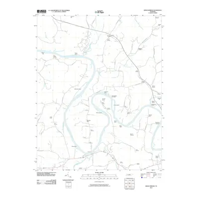
2010 Map of Dixon Springs
USGS Topo · Published 2010About this map
Cumberland River meanders through Smith County, creating a series of dramatic bends and islands that defined the local economy and geography at the turn of the 21st century. The map documents long-standing river crossings and navigational landmarks, most notably the Rome Ferry south of Rome Island. The transition from river-bottom land to upland terrain is marked by prominent natural features such as Scraunchers Rock Bluff, Haynie Pinnacle, and Upton Bluff, which overlook the winding waterway.
Find a feature on this map
101 named features on this map. Tap any name to fly to it.
Don’t see what you’re looking for? This feature index may not catch every label — zoom into the map to look around manually.
Map Details
Editions of this 2010 Dixon Springs Map
This is the sole edition of this map. No revisions or reprints were ever made.
Other maps of this area

1928 · Gordonsville
USGS Topo · 1:62,500

1932 · Carthage
USGS Topo · 1:62,500

1942 · Statesville
USGS Topo · 1:100,000

1956 · Corbin
USGS Topo · 1:250,000

1956 · Nashville
USGS Topo · 1:250,000

1958 · New Middleton
USGS Topo · 1:24,000

1958 · Corbin
USGS Topo · 1:250,000

1958 · Bellwood
USGS Topo · 1:24,000

1958 · Dixon Springs
USGS Topo · 1:24,000
1958 · Shop Springs
USGS Topo · 1:24,000