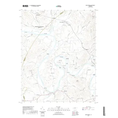
2019 Map of Dixon Springs
USGS Topo · Published 2019About this map
The Cumberland River carves a winding path through this portion of Smith and Trousdale counties, defining a landscape of deep bends and named islands. The river’s course is marked by distinctive features such as Kennys Bend, Beasleys Bend, and Cages Bend, alongside prominent riverside landmarks like Scraunchers Rock Bluff and Upton Bluff. These geographical constraints shaped the settlement patterns of the region, concentrating historic centers like Dixon Springs and Riddleton away from the immediate flood zones, while smaller landings and bars like Bartletts Bar point to the area's river-dependent history.
Find a feature on this map
130 named features on this map. Tap any name to fly to it.
Don’t see what you’re looking for? This feature index may not catch every label — zoom into the map to look around manually.
Map Details
Editions of this 2019 Dixon Springs Map
This is the sole edition of this map. No revisions or reprints were ever made.
Other maps of this area

1928 · Gordonsville
USGS Topo · 1:62,500

1932 · Carthage
USGS Topo · 1:62,500

1942 · Statesville
USGS Topo · 1:100,000

1956 · Corbin
USGS Topo · 1:250,000

1956 · Nashville
USGS Topo · 1:250,000

1958 · New Middleton
USGS Topo · 1:24,000

1958 · Corbin
USGS Topo · 1:250,000

1958 · Bellwood
USGS Topo · 1:24,000

1958 · Dixon Springs
USGS Topo · 1:24,000
1958 · Shop Springs
USGS Topo · 1:24,000