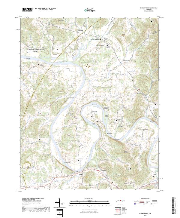
2022 Map of Dixon Springs
USGS Topo · Published 2022About this map
The Cumberland River carves a winding path through this central Tennessee landscape, defining the boundaries between Trousdale and Smith counties. The river's serpentine course is punctuated by several prominent landforms including Kennys Bend, Beasleys Bend, and Cages Bend, alongside numerous islands and bars such as Alexander Island, Parkers Island, and Cotton Bar. These river features once served as critical navigation points and agricultural hubs, as seen in the concentration of family-named cemeteries and settlements along the banks.
Find a feature on this map
138 named features on this map. Tap any name to fly to it.
Don’t see what you’re looking for? This feature index may not catch every label — zoom into the map to look around manually.
Map Details
Editions of this 2022 Dixon Springs Map
This is the sole edition of this map. No revisions or reprints were ever made.
Other maps of this area

1928 · Gordonsville
USGS Topo · 1:62,500

1932 · Carthage
USGS Topo · 1:62,500

1942 · Statesville
USGS Topo · 1:100,000

1956 · Corbin
USGS Topo · 1:250,000

1956 · Nashville
USGS Topo · 1:250,000

1958 · New Middleton
USGS Topo · 1:24,000

1958 · Corbin
USGS Topo · 1:250,000

1958 · Bellwood
USGS Topo · 1:24,000

1958 · Dixon Springs
USGS Topo · 1:24,000
1958 · Shop Springs
USGS Topo · 1:24,000