
1971 Map of Dixon SW
USGS Topo · Published 1974About this map
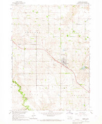
Bull Creek and its southern tributaries wind through this section of Gregory County, carving a network of drainages across the prairie landscape. The area is defined by the three primary townships of Dixon, Edens, and Rhoades, showing the rural agricultural layout of south-central South Dakota in the early 1970s. The map details a sophisticated network of local drainages, including Landing Creek in the northeast and the headwaters of South Fork Whetstone Creek in the southeast. While largely an open agricultural expanse, the survey provides a precise look at the section lines and rural infrastructure that organized the land during this period. The landscape is further characterized by the East Branch Bull Creek and the notable Lone Tree Creek, which indicate the critical role of seasonal water flow in this semi-arid region.
Find a feature on this map
8 named features on this map. Tap any name to fly to it.
Don’t see what you’re looking for? This feature index may not catch every label — zoom into the map to look around manually.
Map Details
Editions of this 1971 Dixon SW Map
This is the sole edition of this map. No revisions or reprints were ever made.
Other maps of this area

1955 · Mitchell
USGS Topo · 1:250,000

1959 · Mitchell
USGS Topo · 1:250,000

1964 · Gregory
USGS Topo · 1:24,000

1964 · Dallas
USGS Topo · 1:24,000
1964 · Burke
USGS Topo · 1:24,000

1971 · Rattlesnake Butte East
USGS Topo · 1:24,000

1971 · Dixon
USGS Topo · 1:24,000

1971 · Colome SE
USGS Topo · 1:24,000

1971 · Dixon SE
USGS Topo · 1:24,000

1971 · Dixon NE
USGS Topo · 1:24,000