
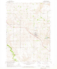
1971 Map of Dixon SE
USGS Topo · Published 1974About this map
Rosebud Indian Reservation lands dominate this corner of Gregory County in the early 1970s, showcasing a landscape defined by the intricate drainage systems of the Missouri River plateau. The northern portion is marked by the winding course of Landing Creek, which carves deep, branching draws through the prairie. To the south, the South Fork Whetstone Creek provides a secondary focal point for the local topography. This 1971 survey illustrates a rural environment primarily organized by township and range lines, with significant landmarks including Rhoades and Burke townships. Sparse human activity is evidenced by a solitary Gravel Pit and a network of unimproved roads that trace the high ridges and valley floors of this traditional tribal territory.
Find a feature on this map
46 named features on this map. Tap any name to fly to it.
Don’t see what you’re looking for? This feature index may not catch every label — zoom into the map to look around manually.
Map Details
Editions of this 1971 Dixon SE Map
This is the sole edition of this map. No revisions or reprints were ever made.
Other maps of this area

1955 · Mitchell
USGS Topo · 1:250,000

1959 · Mitchell
USGS Topo · 1:250,000

1964 · Herrick NW
USGS Topo · 1:24,000

1964 · Gregory
USGS Topo · 1:24,000
1964 · Burke
USGS Topo · 1:24,000

1971 · Lucas NW
USGS Topo · 1:24,000

1971 · Dixon SW
USGS Topo · 1:24,000

1971 · Lucas
USGS Topo · 1:24,000

1971 · Dixon
USGS Topo · 1:24,000

1971 · Dixon NE
USGS Topo · 1:24,000