
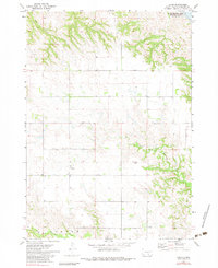
1971 Map of Lucas
USGS Topo · Published 1974About this map
Lucas stands as a central point of reference in this 1971 survey of Gregory County, situated within the boundaries of the Rosebud Indian Reservation. The landscape is defined by the carved valleys of the North Fork and South Fork Whetstone Creek, which wind through the prairie toward the northeast. This era shows the impact of the Pick-Sloan Plan, with Lake Francis Case appearing in the northeast corner of the sheet, its waters backed up by the Fort Randall Dam. Genealogists can locate family sites such as Lucas Cem and the Petersen Cem, while the map also tracks intricate property and field lines across the upland plateaus between Rush Creek and the river breaks.
Find a feature on this map
9 named features on this map. Tap any name to fly to it.
Don’t see what you’re looking for? This feature index may not catch every label — zoom into the map to look around manually.
Map Details
Editions of this 1971 Lucas Map
2 editions found
Other maps of this area

1955 · Mitchell
USGS Topo · 1:250,000

1959 · Mitchell
USGS Topo · 1:250,000

1964 · Herrick NW
USGS Topo · 1:24,000

1964 · Herrick NE
USGS Topo · 1:24,000
1964 · Burke
USGS Topo · 1:24,000

1971 · Lucas NW
USGS Topo · 1:24,000

1971 · Academy
USGS Topo · 1:24,000

1971 · Dixon SE
USGS Topo · 1:24,000

1971 · Dixon NE
USGS Topo · 1:24,000

1971 · Lucas SE
USGS Topo · 1:24,000