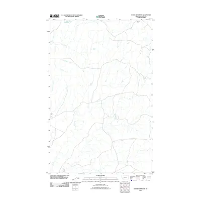
2011 Map of Dodge Reservoir
USGS Topo · Published 2011About this map
Willow Creek and its various tributaries, including the West Fork Willow Creek, carve through this section of Valley County, defining a landscape shaped by water management and ranching access. The presence of the Dodge Reservoir at the northern edge, regulated by the Remulac Dam, underscores the importance of high-plains water storage in this region. Further south, the Etchart Dam sits along the drainage of Deep Creek, which flows toward the southern boundary near Shaw Coulee. This 2011 survey reveals a network of local roads and trails, most notably the East Fork Trl, which provides transit through the open country. The infrastructure suggests a focus on livestock and land management, where named dams and seasonal watercourses are the primary landmarks for navigation across the county.
Find a feature on this map
8 named features on this map. Tap any name to fly to it.
Don’t see what you’re looking for? This feature index may not catch every label — zoom into the map to look around manually.
Map Details
Editions of this 2011 Dodge Reservoir Map
This is the sole edition of this map. No revisions or reprints were ever made.
Other maps of this area

1919 · Boundary
USGS Topo · 1:125,000

1954 · Glasgow
USGS Topo · 1:250,000

1957 · Glasgow
USGS Topo · 1:250,000

1958 · Glasgow
USGS Topo · 1:250,000

1984 · O'Juel Lake
USGS Topo · 1:24,000

1984 · Lighthouse Hill
USGS Topo · 1:24,000

1984 · Opheim
USGS Topo · 1:100,000

1984 · Gay Dam
USGS Topo · 1:24,000

1984 · Dodge Reservoir
USGS Topo · 1:24,000

1984 · Last Chance Reservoir
USGS Topo · 1:24,000