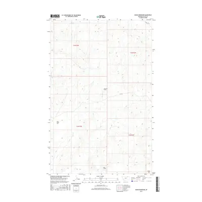
2017 Map of Dodge Reservoir
USGS Topo · Published 2017About this map
Dodge Reservoir sits at the northern edge of this high plains landscape in Valley County, serving as a primary water source in a region defined by its seasonal drainage patterns. The terrain is marked by broad, level stretches such as Wild Horse Flat and Kansas Flats, which are carved by a network of intermittent waterways including Deep Cr and Willow Cr. These natural features, along with names like Lone Tree Coulee and Shaw Coulee, reflect the traditional Montana rangeland character. Human impact is sparse but present through the grid of the Public Land Survey System, which organizes the territory into townships like t36n r38e. Transportation is limited to a few thoroughfares like Theony Rd and the E Fork Trl, highlighting the isolation and agricultural focus of this northern Missouri River basin area during the mid-2010s.
Find a feature on this map
14 named features on this map. Tap any name to fly to it.
Don’t see what you’re looking for? This feature index may not catch every label — zoom into the map to look around manually.
Map Details
Editions of this 2017 Dodge Reservoir Map
This is the sole edition of this map. No revisions or reprints were ever made.
Other maps of this area

1919 · Boundary
USGS Topo · 1:125,000

1954 · Glasgow
USGS Topo · 1:250,000

1957 · Glasgow
USGS Topo · 1:250,000

1958 · Glasgow
USGS Topo · 1:250,000

1984 · O'Juel Lake
USGS Topo · 1:24,000

1984 · Lighthouse Hill
USGS Topo · 1:24,000

1984 · Opheim
USGS Topo · 1:100,000

1984 · Gay Dam
USGS Topo · 1:24,000

1984 · Dodge Reservoir
USGS Topo · 1:24,000

1984 · Last Chance Reservoir
USGS Topo · 1:24,000