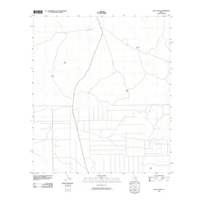
2010 Map of Dog Canyon
USGS Topo · Published 2010About this map
The Old Stage Stand stands as a point of historical transit within this arid reach of Brewster County, marking a landscape defined by intermittent water sources and isolated outposts. Situated near the namesake Dog Canyon, the area's early ranching and travel heritage is evidenced by the presence of Hale Cabin and the seasonal drainage of Hale Draw. These features, alongside the critical water resource at Dewees Tank, highlight the logistical challenges of the Chihuahuan Desert environment. Further south, the course of Terlingua Creek and the rise of Black Hill provide the primary geographic anchors for a region where human infrastructure remains sparse, mostly confined to a grid of local roads and the primary north-south thoroughfare. The map reveals the relationship between early settlement sites and the natural topography of these West Texas canyons.
Find a feature on this map
7 named features on this map. Tap any name to fly to it.
Don’t see what you’re looking for? This feature index may not catch every label — zoom into the map to look around manually.
Map Details
Editions of this 2010 Dog Canyon Map
This is the sole edition of this map. No revisions or reprints were ever made.
Other maps of this area

1917 · Agua Fria
USGS Topo · 1:62,500

1917 · Santiago Peak
USGS Topo · 1:62,500

1917 · Buck Hill
USGS Topo · 1:62,500

1918 · Bone Spring
USGS Topo · 1:125,000

1918 · Buck Hill
USGS Topo · 1:62,500

1918 · Santiago Peak
USGS Topo · 1:62,500

1918 · Nine Point Mesa
USGS Topo · 1:62,500

1925 · Buck Hill
USGS Topo · 1:62,500

1937 · Nine Point Mesa
USGS Topo · 1:62,500

1937 · Agua Fria
USGS Topo · 1:62,500