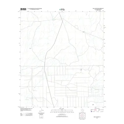
2012 Map of Dog Canyon
USGS Topo · Published 2012About this map
Old Stage Stand stands as a remnant of frontier transit in this arid landscape of Brewster County. The terrain is defined by the namesake Dog Canyon and the prominent rising of Black Hill in the southeast. While modern roadways now traverse the desert, the map documents historical points of habitation and resource management, including Hale Cabin and water catchments like Dewees Tank. The intermittent drainage of Terlingua Cr carves through the western portion of the quadrangle, illustrating the vital role of seasonal waterways in this part of Texas. This 2012 survey provides a clear look at how human footprints like old stage stops persist alongside natural features in a sparsely populated environment.
Find a feature on this map
6 named features on this map. Tap any name to fly to it.
Don’t see what you’re looking for? This feature index may not catch every label — zoom into the map to look around manually.
Map Details
Editions of this 2012 Dog Canyon Map
This is the sole edition of this map. No revisions or reprints were ever made.
Other maps of this area

1917 · Agua Fria
USGS Topo · 1:62,500

1917 · Santiago Peak
USGS Topo · 1:62,500

1917 · Buck Hill
USGS Topo · 1:62,500

1918 · Bone Spring
USGS Topo · 1:125,000

1918 · Buck Hill
USGS Topo · 1:62,500

1918 · Santiago Peak
USGS Topo · 1:62,500

1918 · Nine Point Mesa
USGS Topo · 1:62,500

1925 · Buck Hill
USGS Topo · 1:62,500

1937 · Nine Point Mesa
USGS Topo · 1:62,500

1937 · Agua Fria
USGS Topo · 1:62,500